
Bintan Island topographic map
Interactive map
Click on the map to display elevation.
About this map
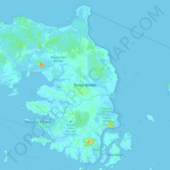
Name: Bintan Island topographic map, elevation, terrain.
Location: Bintan Island, Bintan, Riau Islands, Indonesia (0.80955 104.21381 1.22980 104.66024)
Average elevation: 6 m
Minimum elevation: -4 m
Maximum elevation: 323 m
Other topographic maps
Click on a map to view its topography, its elevation and its terrain.
Kijang
Indonesia > Riau Islands > Bintan
Kijang, Bintan, Riau Islands, 29151, Indonesia
Average elevation: 5 m