Geolocate

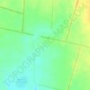
Kvitky topographic map

Click on the map to display elevation.

About this map

Name: Kvitky topographic map, elevation, terrain.

Location: Kvitky, Селищенська сільська громада, Zvenyhorodka Raion, Cherkasy Oblast, 19446, Ukraine (49.29357 31.21674 49.33667 31.27228)

Average elevation: 171 m

Minimum elevation: 124 m

Maximum elevation: 232 m

Other topographic maps

Click on a map to view its topography, its elevation and its terrain.

Antonina

Ukraine > Cherkasy Oblast

Average elevation: 260 m

Dnieper River

Ukraine > Cherkasy Oblast

The source of the Dnieper is the sedge bogs (Akseninsky Mokh) of the Valdai Hills in central Russia, at an elevation of 220 m (720 ft). For 115 km (71 mi) of its length, it serves as the border between Belarus and Ukraine. Its estuary, or liman, used to be defended by the strong fortress of Ochakiv.

Average elevation: 83 m
Ratseve

Ukraine > Cherkasy Oblast

Average elevation: 95 m

Kostiantynivka

Ukraine > Cherkasy Oblast

Average elevation: 123 m

Talne

Ukraine > Cherkasy Oblast

Average elevation: 172 m

Zhashkiv

Ukraine > Cherkasy Oblast

Average elevation: 230 m

Impact crater

Ukraine > Cherkasy Oblast

Average elevation: 246 m

Vodianyky

Ukraine > Cherkasy Oblast

Average elevation: 210 m

Kheilove

Ukraine > Cherkasy Oblast

Average elevation: 232 m

Zhurzhyntsi

Ukraine > Cherkasy Oblast

Average elevation: 219 m

Gear up for your next adventure:

🎒Replacement Sternum Straps - Repair parts for hiking rucksacks
🥾Women's Waterproof Hiking Boots - High-performance trekking boots designed for all-weather comfort
🧘Folding Sit Mats - Dry and warm seat for map-reading breaks on damp ground
🚲Bikepacking Frame Bags - Storage for tools and navigation gear on long off-road rides
🔪Outdoor Multi-Tools - Versatile tools for gear repairs and food prep in the wild

As an Amazon Associate, this site earns from qualifying purchases at no extra cost to you.