
Kalače topographic map
Interactive map
Click on the map to display elevation.
About this map
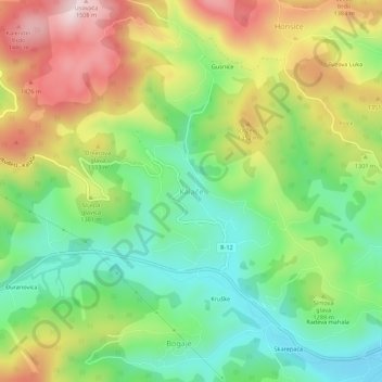
Name: Kalače topographic map, elevation, terrain.
Location: Kalače, Gemeinde Rožaje, Montenegro (42.83963 20.07025 42.87963 20.11025)
Average elevation: 1,251 m
Minimum elevation: 1,078 m
Maximum elevation: 1,500 m