
Light Oak topographic map
Interactive map
Click on the map to display elevation.
About this map
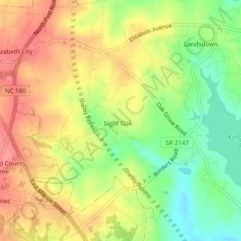
Name: Light Oak topographic map, elevation, terrain.
Location: Light Oak, Cleveland County, North Carolina, United States (35.27443 -81.49101 35.29590 -81.46318)
Average elevation: 254 m
Minimum elevation: 212 m
Maximum elevation: 289 m