
Lägern topographic map
Interactive map
Click on the map to display elevation.
About this map
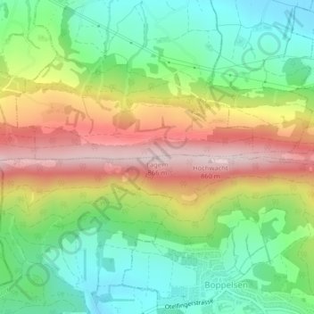
Name: Lägern topographic map, elevation, terrain.
Location: Lägern, Boppelsen, Bezirk Dielsdorf, Zürich, 8113, Schweiz (47.48177 8.39380 47.48187 8.39390)
Average elevation: 618 m
Minimum elevation: 464 m
Maximum elevation: 834 m
Flugaufnahme des bewaldeten Höhenrückens (1963)