
Arres topographic map
Interactive map
Click on the map to display elevation.
About this map
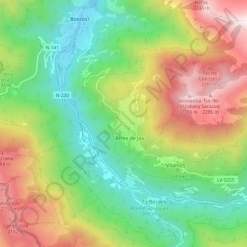
Name: Arres topographic map, elevation, terrain.
Location: Arres, Val d'Aran, Catalonië, 25551, Spanje (42.73802 0.66281 42.77845 0.75199)
Average elevation: 1,371 m
Minimum elevation: 701 m
Maximum elevation: 2,406 m
Other topographic maps
Click on a map to view its topography, its elevation and its terrain.
Unha
Spanje > Catalonië > Val d'Aran > Salardú
Unha, Salardú, Naut Aran, Val d'Aran, Catalonië, 25599, Spanje
Average elevation: 1,596 m