
Rimpar topographic map
Interactive map
Click on the map to display elevation.
About this map
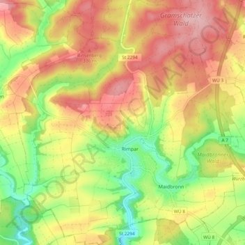
Name: Rimpar topographic map, elevation, terrain.
Location: Rimpar, Landkreis Würzburg, Bayern, 97222, Deutschland (49.83329 9.91572 49.89330 10.00140)
Average elevation: 294 m
Minimum elevation: 212 m
Maximum elevation: 367 m