
Beeskow topographic map
Interactive map
Click on the map to display elevation.
About this map
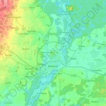
Name: Beeskow topographic map, elevation, terrain.
Location: Beeskow, Oder-Spree, Brandenburg, 15848, Deutschland (52.13095 14.17677 52.24371 14.37756)
Average elevation: 57 m
Minimum elevation: 35 m
Maximum elevation: 121 m
Zusätzlich werden folgende Wohnplätze ausgewiesen: Bahrensdorf, Bornower Berg, Charlottenhof, Hannemannei, Hufenfeld, Kietz, Radinkendorf Ausbau, Vorheide, Weinberge und Wilhelmshöhe.