
Bellershausen topographic map
Interactive map
Click on the map to display elevation.
About this map
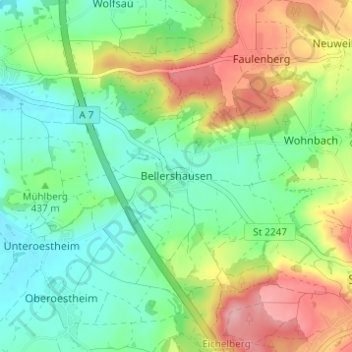
Name: Bellershausen topographic map, elevation, terrain.
Average elevation: 440 m
Minimum elevation: 388 m
Maximum elevation: 531 m
Other topographic maps
Click on a map to view its topography, its elevation and its terrain.
Wittenbach
Deutschland > Bayern > Landkreis Ansbach
Wittenbach, Wilburgstetten, Wilburgstetten (VGem), Landkreis Ansbach, Bayern, 91634, Deutschland
Average elevation: 461 m