
Όλυμπος topographic map
Interactive map
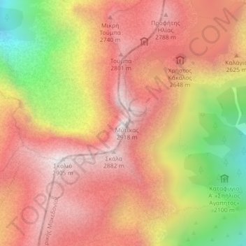
Click on the map to display elevation.
About this map
Name: Όλυμπος topographic map, elevation, terrain.
Average elevation: 2,456 m
Minimum elevation: 1,746 m
Maximum elevation: 2,897 m
Other topographic maps
Click on a map to view its topography, its elevation and its terrain.
Σαραντάπορο
Greece > Thessaly and Central Greece > Larisa Regional Unit > Elassona Municipality > Σαραντάπορο
Average elevation: 797 m