
Krivodol topographic map
Interactive map
Click on the map to display elevation.
About this map
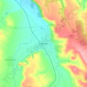
Name: Krivodol topographic map, elevation, terrain.
Location: Krivodol, Vratsa, Bulgaria (43.32751 23.43514 43.40751 23.51514)
Average elevation: 186 m
Minimum elevation: 122 m
Maximum elevation: 280 m
Other topographic maps
Click on a map to view its topography, its elevation and its terrain.