Geolocate

Reedsburg topographic map

Click on the map to display elevation.

About this map

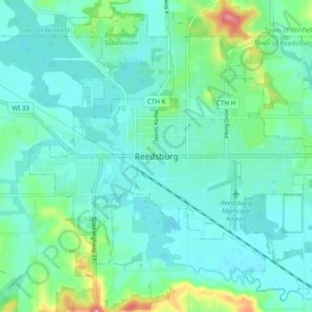
Name: Reedsburg topographic map, elevation, terrain.

Location: Reedsburg, Sauk County, Wisconsin, United States (43.50531 -90.03562 43.55953 -89.95470)

Average elevation: 281 m

Minimum elevation: 261 m

Maximum elevation: 359 m

Other topographic maps

Click on a map to view its topography, its elevation and its terrain.

Hill Point

United States > Wisconsin > Sauk County

Average elevation: 331 m

Cassell

United States > Wisconsin > Sauk County

Average elevation: 238 m

Gear up for your next adventure:

📷Outdoor Action Cameras - Cameras designed for hiking and adventure
🧣Neck Gaiters - Versatile protection against wind and cold
🚲Cycling GPS Computers - Track elevation and topographic routes on two wheels
🩹Hiking First Aid Kits - Compact medical kits tailored for trail injuries and emergencies
🧊Insulated Flasks - Keeps drinks hot or cold during hikes

As an Amazon Associate, this site earns from qualifying purchases at no extra cost to you.