
Manchester topographic map
Click on the map to display elevation.
About this map
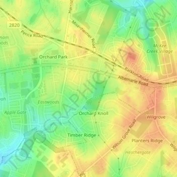
Name: Manchester topographic map, elevation, terrain.
Average elevation: 234 m
Minimum elevation: 210 m
Maximum elevation: 250 m
Other topographic maps
Click on a map to view its topography, its elevation and its terrain.
Spring Valley
United States > North Carolina > Mecklenburg County > Charlotte
Average elevation: 201 m
Sharon Colony
United States > North Carolina > Mecklenburg County > Charlotte
Average elevation: 201 m
Mountainbrook
United States > North Carolina > Mecklenburg County > Charlotte
Average elevation: 202 m
Morning Star Acres
United States > North Carolina > Mecklenburg County > Charlotte
Average elevation: 206 m
Old Providence
United States > North Carolina > Mecklenburg County > Charlotte
Average elevation: 192 m
Montclaire South
United States > North Carolina > Mecklenburg County > Charlotte
Average elevation: 202 m