
Tres Arroyos topographic map
Interactive map
Click on the map to display elevation.
About this map
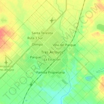
Name: Tres Arroyos topographic map, elevation, terrain.
Average elevation: 112 m
Minimum elevation: 91 m
Maximum elevation: 141 m
Other topographic maps
Click on a map to view its topography, its elevation and its terrain.
General Villegas
Argentinien > Provinz Buenos Aires > General Villegas
General Villegas, Partido de General Villegas, Provinz Buenos Aires, 6230, Argentinien
Average elevation: 115 m
Veinte de Junio
Argentinien > Provinz Buenos Aires > Veinte de Junio
Veinte de Junio, Partido de La Matanza, Provinz Buenos Aires, Argentinien
Average elevation: 21 m