
Bayaguana topographic map
Interactive map
Click on the map to display elevation.
About this map
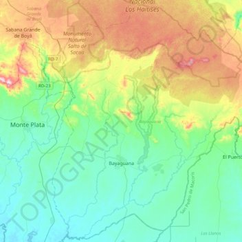
Name: Bayaguana topographic map, elevation, terrain.
Location: Bayaguana, Monte Plata, Dominican Republic (18.63858 -69.74573 18.99161 -69.36479)
Average elevation: 144 m
Minimum elevation: 6 m
Maximum elevation: 476 m
Other topographic maps
Click on a map to view its topography, its elevation and its terrain.