
Anneville topographic map
Interactive map
Click on the map to display elevation.
About this map
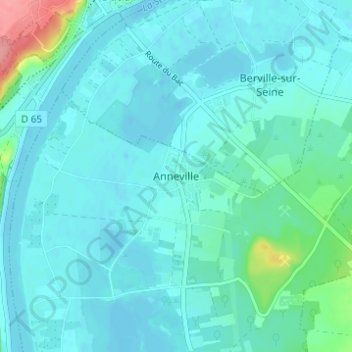
Name: Anneville topographic map, elevation, terrain.
Average elevation: 12 m
Minimum elevation: -1 m
Maximum elevation: 91 m
Other topographic maps
Click on a map to view its topography, its elevation and its terrain.
Ambourville
France > Normandie > Seine-Maritime > Anneville-Ambourville
Ambourville, Anneville-Ambourville, Rouen, Seine-Maritime, Normandie, France métropolitaine, 76480, France
Average elevation: 22 m