Geolocate

Damodarpur topographic map

Click on the map to display elevation.

About this map

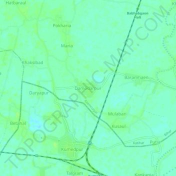
Name: Damodarpur topographic map, elevation, terrain.

Location: Damodarpur, Azamnagar, Katihar, Bihar, India (25.42702 87.78439 25.46702 87.82439)

Average elevation: 28 m

Minimum elevation: 23 m

Maximum elevation: 32 m

Gear up for your next adventure:

🥄Titanium Camping Sporks - The ultimate lightweight utensil for trail meals
📚UK Hiking Guidebooks - Detailed route descriptions for the Lake District, Peaks, and Highlands
🎒Multi-day Trekking Packs - Large capacity backpacks for wild camping and long-distance trails
👖Convertible Hiking Trousers - Versatile zip-off pants for changing mountain weather conditions
🚲Cycling GPS Computers - Track elevation and topographic routes on two wheels

As an Amazon Associate, this site earns from qualifying purchases at no extra cost to you.