
Stammham topographic map
Interactive map
Click on the map to display elevation.
About this map
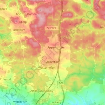
Name: Stammham topographic map, elevation, terrain.
Location: Stammham, Landkreis Eichstätt, Beieren, 85134, Duitsland (48.83281 11.40297 48.90212 11.54426)
Average elevation: 466 m
Minimum elevation: 385 m
Maximum elevation: 540 m
Other topographic maps
Click on a map to view its topography, its elevation and its terrain.
Beilngries
Duitsland > Beieren > Landkreis Eichstätt
Beilngries, Landkreis Eichstätt, Beieren, 92339, Duitsland
Average elevation: 480 m