Geolocate

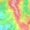
Leira topographic map

Click on the map to display elevation.

About this map

Name: Leira topographic map, elevation, terrain.

Location: Leira, Lobão, Gião, Louredo e Guisande, Santa Maria da Feira, Aveiro, 4525-340, Portugal (40.94530 -8.50030 40.98530 -8.46030)

Average elevation: 229 m

Minimum elevation: 121 m

Maximum elevation: 397 m

Other topographic maps

Click on a map to view its topography, its elevation and its terrain.
Escapães

Portugal > Aveiro > Santa Maria da Feira

Average elevation: 227 m

Gear up for your next adventure:

📢Survival Whistles - Essential safety gear for signaling for help in mountain fog
📦Dry Bags - Waterproof bags to protect gear from rain
🌦️Portable Weather Meters - Handheld tools for monitoring weather conditions
🧷Tenacious Repair Tape - Instant fix for torn tents, jackets, or dry bags
🧰First Aid Kits - Essential safety kits for outdoor activities

As an Amazon Associate, this site earns from qualifying purchases at no extra cost to you.