Bloomington topographic map
Click on the map to display elevation.
Bloomington
Bloomington is an area of irregular limestone terrain characterized by sinks, ravines, fissures, underground streams, sinking streams, springs and caves. It is in the rolling hills of south Central Indiana, resting on the intersection of the Norman Upland and the Mitchell Plain. The city's relatively varied topography is a sharp contrast to the flatter terrain more typical of central to northern portions of Indiana.
About this map
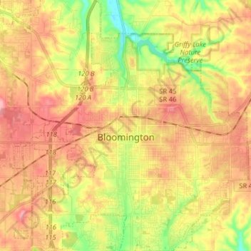
Name: Bloomington topographic map, elevation, terrain.
Location: Bloomington, Monroe County, Indiana, United States (39.12133 -86.59189 39.22136 -86.47113)
Average elevation: 241 m
Minimum elevation: 177 m
Maximum elevation: 293 m
Other topographic maps
Click on a map to view its topography, its elevation and its terrain.