Geolocate

Montezuma topographic map

Click on the map to display elevation.

About this map
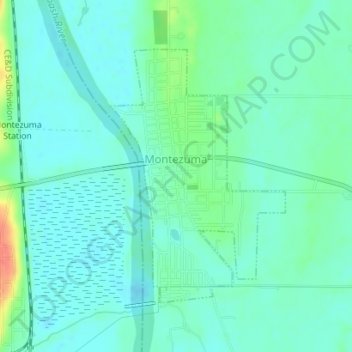
Name: Montezuma topographic map, elevation, terrain.

Location: Montezuma, Parke County, Indiana, 47862, United States (39.78182 -87.37740 39.80126 -87.36217)

Average elevation: 153 m

Minimum elevation: 141 m

Maximum elevation: 192 m

Other topographic maps

Click on a map to view its topography, its elevation and its terrain.
Pin Hook

United States > Indiana > Parke County

Average elevation: 209 m

Gear up for your next adventure:

📷Camera Straps - Secure straps for carrying cameras while walking
🔦Waterproof LED Headlamps - Hands-free lighting for evening treks and emergency navigation
👕Merino Base Layers - Natural temperature regulation for cold weather hiking and camping
🕶️Polarized Sunglasses - Reduces glare from snow and water when reading terrain
👟Waterproof Leg Gaiters - Keep mud and water out of your boots in boggy terrain

As an Amazon Associate, this site earns from qualifying purchases at no extra cost to you.