
Pamba topographic map
Interactive map
Click on the map to display elevation.
About this map
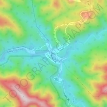
Name: Pamba topographic map, elevation, terrain.
Location: Pamba, Konni, Pathanamthitta, Kerala, India (9.39610 77.04765 9.43610 77.08765)
Average elevation: 345 m
Minimum elevation: 155 m
Maximum elevation: 693 m
Other topographic maps
Click on a map to view its topography, its elevation and its terrain.
Angamoozhy
Angamoozhy is geographically a high-range area (Malanadu) situated in the south eastern part of Kerala and very close to the Western ghats mountain ranges. It has an average elevation of 18 m (59 ft) above sea level.
Average elevation: 233 m