
Várzea topographic map
Interactive map
Click on the map to display elevation.
About this map
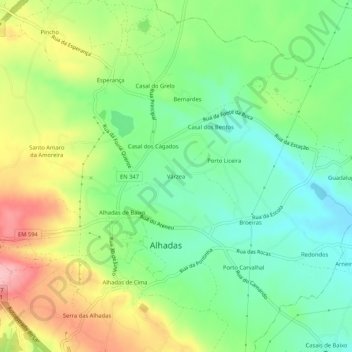
Name: Várzea topographic map, elevation, terrain.
Location: Várzea, Alhadas, Figueira da Foz, Coimbra, 3090-466, Portugal (40.17770 -8.80234 40.21770 -8.76234)
Average elevation: 64 m
Minimum elevation: 8 m
Maximum elevation: 151 m
Other topographic maps
Click on a map to view its topography, its elevation and its terrain.
Seixido
Portugal > Coimbra > Figueira da Foz > Alhadas
Seixido, Alhadas, Figueira da Foz, Coimbra, 3090-466, Portugal
Average elevation: 35 m