Geolocate

Paragu topographic map

Click on the map to display elevation.

About this map

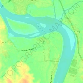
Name: Paragu topographic map, elevation, terrain.

Location: Paragu, Tumauini, Isabela, Cagayan Valley, 3325, Philippines (17.23271 121.80030 17.27271 121.84030)

Average elevation: 33 m

Minimum elevation: 18 m

Maximum elevation: 53 m

Gear up for your next adventure:

📱Rugged Phone Cases - Heavy-duty protection for smartphones used as secondary GPS tools
🗺️Topographic Maps - Detailed maps showing elevation and terrain features
🎒Hiking Daypacks (20L) - Compact backpacks for day trips and technical mountain ascents
🦯Walking Poles - Supportive poles for long-distance walking
🛌Sleeping Mats - Insulated mats for comfortable outdoor sleeping

As an Amazon Associate, this site earns from qualifying purchases at no extra cost to you.