
Thank you for supporting this site ❤️
Make a donation
Make a donation
Gear up for your next adventure:
As an Amazon Associate, this site earns from qualifying purchases at no extra cost to you.
Kibid topographic map
Click on the map to display elevation.
Thank you for supporting this site ❤️
Make a donation
Make a donation
Gear up for your next adventure:
As an Amazon Associate, this site earns from qualifying purchases at no extra cost to you.
About this map
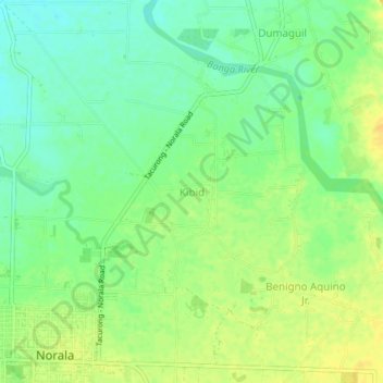
Name: Kibid topographic map, elevation, terrain.
Location: Kibid, Norala, South Cotabato, Soccsksargen, 9508, Philippines (6.51838 124.65487 6.55838 124.69487)
Average elevation: 98 m
Minimum elevation: 85 m
Maximum elevation: 110 m
Thank you for supporting this site ❤️
Make a donation
Make a donation
Gear up for your next adventure:
As an Amazon Associate, this site earns from qualifying purchases at no extra cost to you.