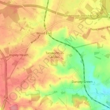
Tanworth-in-Arden topographic map
Interactive map
Click on the map to display elevation.
About this map
Name: Tanworth-in-Arden topographic map, elevation, terrain.
Average elevation: 145 m
Minimum elevation: 98 m
Maximum elevation: 177 m

Click on the map to display elevation.
Name: Tanworth-in-Arden topographic map, elevation, terrain.
Average elevation: 145 m
Minimum elevation: 98 m
Maximum elevation: 177 m