
Zapotal topographic map
Interactive map
Click on the map to display elevation.
About this map
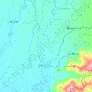
Name: Zapotal topographic map, elevation, terrain.
Location: Zapotal, Ventanas, Los Ríos, Ecuador (-1.40186 -79.55199 -1.12280 -79.26748)
Average elevation: 136 m
Minimum elevation: 16 m
Maximum elevation: 1,183 m