
Aspur topographic map
Interactive map
Click on the map to display elevation.
About this map
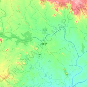
Name: Aspur topographic map, elevation, terrain.
Average elevation: 223 m
Minimum elevation: 140 m
Maximum elevation: 502 m
Other topographic maps
Click on a map to view its topography, its elevation and its terrain.
Modran
India > Rajasthan > Aspur Tehsil > Modran
Modran, Aspur Tehsil, Dungarpur, Rajasthan, India
Average elevation: 191 m