
Thank you for supporting this site ❤️
Make a donation
Make a donation
Gear up for your next adventure:
As an Amazon Associate, this site earns from qualifying purchases at no extra cost to you.
Shivakote topographic map
Click on the map to display elevation.
Thank you for supporting this site ❤️
Make a donation
Make a donation
Gear up for your next adventure:
As an Amazon Associate, this site earns from qualifying purchases at no extra cost to you.
About this map
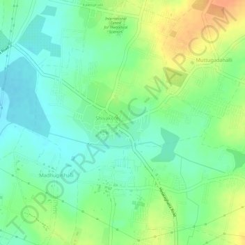
Name: Shivakote topographic map, elevation, terrain.
Location: Shivakote, Yelahanka taluku, Bengaluru Urban, Karnataka, India (13.11997 77.50459 13.14810 77.52568)
Average elevation: 878 m
Minimum elevation: 860 m
Maximum elevation: 901 m
Thank you for supporting this site ❤️
Make a donation
Make a donation
Gear up for your next adventure:
As an Amazon Associate, this site earns from qualifying purchases at no extra cost to you.