Geolocate

Tweed topographic map

Click on the map to display elevation.

About this map
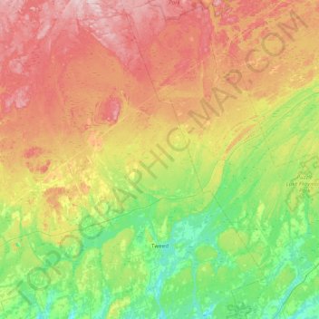
Name: Tweed topographic map, elevation, terrain.

Location: Tweed, Hastings County, Central Ontario, Ontario, Canada (44.34936 -77.56817 44.89950 -77.05544)

Average elevation: 231 m

Minimum elevation: 127 m

Maximum elevation: 388 m

Other topographic maps

Click on a map to view its topography, its elevation and its terrain.

Stirling

Canada > Ontario > Hastings County > Stirling-Rawdon

Average elevation: 134 m

Coe Hill

Canada > Ontario > Hastings County > Wollaston

Average elevation: 327 m

Marmora

Canada > Ontario > Hastings County > Marmora and Lake

Average elevation: 200 m

Maynooth

Canada > Ontario > Hastings County > Hastings Highlands

Average elevation: 426 m

Actinolite

Canada > Ontario > Hastings County > Tweed

Average elevation: 175 m

Marlbank

Canada > Ontario > Hastings County > Tweed

Average elevation: 176 m

Ormsby

Canada > Ontario > Hastings County > Limerick

Average elevation: 349 m

Fosters Lake

Canada > Ontario > Hastings County > Carlow/Mayo

Average elevation: 302 m

Drag Lake

Canada > Ontario > Hastings County > Centre Hastings

Average elevation: 184 m

Highway 7

Canada > Ontario > Hastings County > Highway 7

Average elevation: 198 m

Madoc

Canada > Ontario > Hastings County > Centre Hastings > Madoc

Average elevation: 172 m

Gunter Lake

Canada > Ontario > Hastings County > Tudor and Cashel

Average elevation: 273 m

Thomasburg

Canada > Ontario > Hastings County > Tweed

Average elevation: 160 m

Roslin

Canada > Ontario > Hastings County > Centre Hastings

Average elevation: 147 m

Queensborough

Canada > Ontario > Hastings County > Tweed

Average elevation: 207 m

Boulter

Canada > Ontario > Hastings County > Carlow/Mayo

Average elevation: 352 m

Snake Lake

Canada > Ontario > Hastings County > Centre Hastings

Average elevation: 187 m

Ivanhoe

Canada > Ontario > Hastings County > Centre Hastings

Average elevation: 175 m

Shannonville

Canada > Ontario > Hastings County

Average elevation: 87 m

Elzevir Lake

Canada > Ontario > Hastings County > Tweed

Average elevation: 269 m

Millbridge

Canada > Ontario > Hastings County > Tudor and Cashel

Average elevation: 285 m

Gilmour

Canada > Ontario > Hastings County > Tudor and Cashel

Average elevation: 319 m

Gear up for your next adventure:

🧤Thermal Touchscreen Gloves - Stay warm while operating your GPS or smartphone camera
🧷Tenacious Repair Tape - Instant fix for torn tents, jackets, or dry bags
🗺️Ordnance Survey Maps - Official UK maps for walking and outdoor activities
🧣Fleece Neck Warmers - Extra insulation for winter topographic surveys
🦟Anti-Midge & Tick Repellent - Vital for hiking in the Scottish Highlands during summer

As an Amazon Associate, this site earns from qualifying purchases at no extra cost to you.