
Thank you for supporting this site ❤️
Make a donation
Make a donation
Gear up for your next adventure:
As an Amazon Associate, this site earns from qualifying purchases at no extra cost to you.
Tenjo topographic map
Click on the map to display elevation.
Thank you for supporting this site ❤️
Make a donation
Make a donation
Gear up for your next adventure:
As an Amazon Associate, this site earns from qualifying purchases at no extra cost to you.
About this map
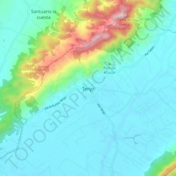
Name: Tenjo topographic map, elevation, terrain.
Location: Tenjo, Sabana Centro, RAP (Especial) Central, 250207, Colombia (4.83200 -74.18497 4.91200 -74.10497)
Average elevation: 2,682 m
Minimum elevation: 2,552 m
Maximum elevation: 3,221 m
Thank you for supporting this site ❤️
Make a donation
Make a donation
Gear up for your next adventure:
As an Amazon Associate, this site earns from qualifying purchases at no extra cost to you.