Geolocate

Port Ryerse topographic map

Click on the map to display elevation.

About this map

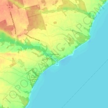
Name: Port Ryerse topographic map, elevation, terrain.

Location: Port Ryerse, Norfolk County, Ontario, N3Y 4K2, Canada (42.73745 -80.27816 42.77745 -80.23816)

Average elevation: 191 m

Minimum elevation: 170 m

Maximum elevation: 222 m

Gear up for your next adventure:

🔭Compact Hiking Binoculars - Lightweight optics for scouting terrain and spotting wildlife
🔪Outdoor Multi-Tools - Versatile tools for gear repairs and food prep in the wild
Lightweight Tents - Compact tents for backpacking and trekking
🎒Replacement Sternum Straps - Repair parts for hiking rucksacks
🍳Camping Stoves - Compact stoves for outdoor cooking

As an Amazon Associate, this site earns from qualifying purchases at no extra cost to you.