Geolocate

Mathiana topographic map

Click on the map to display elevation.

About this map

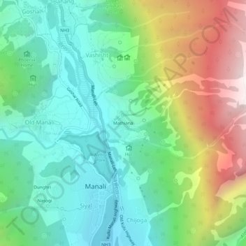
Name: Mathiana topographic map, elevation, terrain.

Location: Mathiana, Manali, Kullu, Himachal Pradesh, 175131, India (32.23578 77.17260 32.27578 77.21260)

Average elevation: 2,390 m

Minimum elevation: 1,845 m

Maximum elevation: 3,529 m

Gear up for your next adventure:

🧰First Aid Kits - Essential safety kits for outdoor activities
🔪Outdoor Multi-Tools - Versatile tools for gear repairs and food prep in the wild
🧥Breathable Waterproof Jackets - Essential rain protection for the unpredictable British climate
🧢Thermal Beanie Hats - Prevent heat loss from the head in windy summit conditions
🎒Hiking Child Carriers - Explore the outdoors with the whole family safely

As an Amazon Associate, this site earns from qualifying purchases at no extra cost to you.