
Thank you for supporting this site ❤️
Make a donation
Make a donation
Gear up for your next adventure:
As an Amazon Associate, this site earns from qualifying purchases at no extra cost to you.
Kidimu topographic map
Click on the map to display elevation.
Thank you for supporting this site ❤️
Make a donation
Make a donation
Gear up for your next adventure:
As an Amazon Associate, this site earns from qualifying purchases at no extra cost to you.
About this map
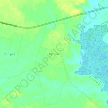
Name: Kidimu topographic map, elevation, terrain.
Location: Kidimu, Pongwe Kikoneni ward, Lunga Lunga, Kwale, Coast, Kenya (-4.57000 39.34660 -4.53000 39.38660)
Average elevation: 10 m
Minimum elevation: 1 m
Maximum elevation: 20 m
Thank you for supporting this site ❤️
Make a donation
Make a donation
Gear up for your next adventure:
As an Amazon Associate, this site earns from qualifying purchases at no extra cost to you.