
حي النسيم topographic map
Interactive map
Click on the map to display elevation.
About this map
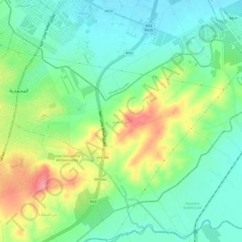
Name: حي النسيم topographic map, elevation, terrain.
Location: حي النسيم, معتمدية المحمدية, Ben Arous, Tunisia (36.65792 10.15544 36.68948 10.21369)
Average elevation: 52 m
Minimum elevation: 14 m
Maximum elevation: 122 m
Other topographic maps
Click on a map to view its topography, its elevation and its terrain.