Geolocate

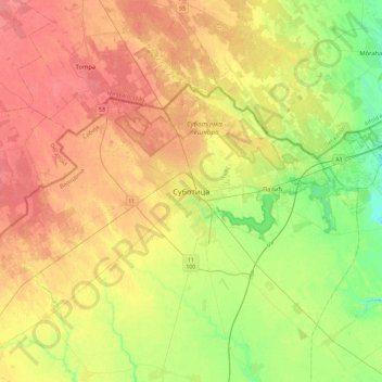
Subotica topographic map

Click on the map to display elevation.

Subotica

It is located in the Pannonian Basin at 46.07° North, 19.68° East, at the altitude of 109m, about 10 kilometres (6 miles) from the border with Hungary, and is the northernmost city in Serbia. Lake Palić is in the immediate vicinity of the city. Sand dunes area Subotička Peščara is located north of the city, along the Hungarian border.

Wikipedia (CC-BY-SA 3.0)

About this map

Name: Subotica topographic map, elevation, terrain.

Location: Subotica, City of Subotica, North Backa Administrative District, Vojvodina, 24000, Serbia (45.94021 19.50533 46.26021 19.82533)

Average elevation: 115 m

Minimum elevation: 87 m

Maximum elevation: 140 m

Other topographic maps

Click on a map to view its topography, its elevation and its terrain.

Gear up for your next adventure:

🎒Hiking Daypacks - Compact backpacks ideal for short hikes and excursions
🖼️Topographic Map Art - Decorative 3D-effect posters of famous UK peaks and regions
🧦Hiking Socks - Breathable socks designed to prevent blisters on long walks
🧊Insulated Flasks - Keeps drinks hot or cold during hikes
🦯Walking Poles - Supportive poles for long-distance walking

As an Amazon Associate, this site earns from qualifying purchases at no extra cost to you.