
Thank you for supporting this site ❤️
Make a donation
Make a donation
Gear up for your next adventure:
As an Amazon Associate, this site earns from qualifying purchases at no extra cost to you.
Lukindo topographic map
Click on the map to display elevation.
Thank you for supporting this site ❤️
Make a donation
Make a donation
Gear up for your next adventure:
As an Amazon Associate, this site earns from qualifying purchases at no extra cost to you.
About this map
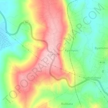
Name: Lukindo topographic map, elevation, terrain.
Location: Lukindo, Katoma, Bukoba, Kagera, Lake Zone, Tanzania (-1.31731 31.74152 -1.27731 31.78152)
Average elevation: 1,245 m
Minimum elevation: 1,150 m
Maximum elevation: 1,357 m
Thank you for supporting this site ❤️
Make a donation
Make a donation
Gear up for your next adventure:
As an Amazon Associate, this site earns from qualifying purchases at no extra cost to you.