Geolocate

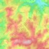
Le Barry topographic map

Click on the map to display elevation.

About this map

Name: Le Barry topographic map, elevation, terrain.

Location: Le Barry, Pigerolles, Gentioux-Pigerolles, Aubusson, Creuse, Nouvelle-Aquitaine, France métropolitaine, 23340, France (45.77185 2.05723 45.79185 2.07723)

Average elevation: 818 m

Minimum elevation: 729 m

Maximum elevation: 894 m

Other topographic maps

Click on a map to view its topography, its elevation and its terrain.
Gear up for your next adventure:

🌄Compact Monoculars - Lightweight optics for hiking
🧥Breathable Waterproof Jackets - Essential rain protection for the unpredictable British climate
🥾Men's Waterproof Hiking Boots - Durable footwear with deep lugs for muddy and rocky UK terrains
🎿Telescopic Trekking Poles - Reduces knee strain on steep topographic descents
🧥Softshell Jackets - Breathable jackets for active outdoor use

As an Amazon Associate, this site earns from qualifying purchases at no extra cost to you.