
Mouas topographic map
Interactive map
Click on the map to display elevation.
About this map
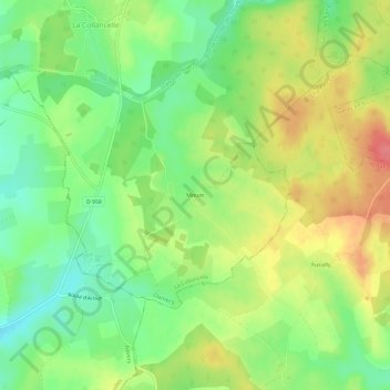
Name: Mouas topographic map, elevation, terrain.
Average elevation: 288 m
Minimum elevation: 256 m
Maximum elevation: 325 m
Other topographic maps
Click on a map to view its topography, its elevation and its terrain.
Étang de Perchette
France > Bourgogne-Franche-Comté > Nièvre > La Collancelle > Vaux
Étang de Perchette, Vaux, La Collancelle, Clamecy, Nièvre, Bourgogne-Franche-Comté, France métropolitaine, 58800, France
Average elevation: 279 m