
Bereldange topographic map
Interactive map
Click on the map to display elevation.
About this map
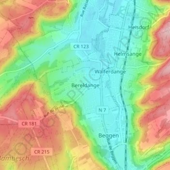
Name: Bereldange topographic map, elevation, terrain.
Location: Bereldange, Canton Luxembourg, 7217, Luxembourg (49.63526 6.10160 49.67526 6.14160)
Average elevation: 298 m
Minimum elevation: 224 m
Maximum elevation: 409 m