
Hoherodskopf topographic map
Interactive map
Click on the map to display elevation.
About this map
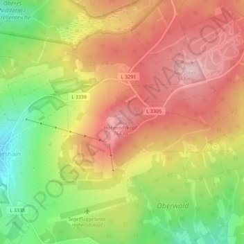
Name: Hoherodskopf topographic map, elevation, terrain.
Average elevation: 681 m
Minimum elevation: 565 m
Maximum elevation: 772 m
Other topographic maps
Click on a map to view its topography, its elevation and its terrain.
Vogelsberg
Deutschland > Hessen > Schotten
Vogelsberg, Schotten, Vogelsbergkreis, Regierungsbezirk Gießen, Hessen, Deutschland
Average elevation: 316 m