
Monte Negro topographic map
Interactive map
Click on the map to display elevation.
About this map
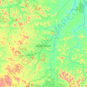
Name: Monte Negro topographic map, elevation, terrain.
Average elevation: 189 m
Minimum elevation: 99 m
Maximum elevation: 456 m
Other topographic maps
Click on a map to view its topography, its elevation and its terrain.
Seringueiras
Brasil > Rondonia > Seringueiras
Seringueiras, Microrregião Alvorada d'Oeste, Mesorregião Leste Rondoniense, Rondonia, Región Norte, Brasil
Average elevation: 190 m