
Les Épinettes topographic map
Interactive map
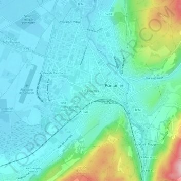
Click on the map to display elevation.
About this map
Name: Les Épinettes topographic map, elevation, terrain.
Average elevation: 859 m
Minimum elevation: 810 m
Maximum elevation: 1,058 m
Other topographic maps
Click on a map to view its topography, its elevation and its terrain.
Le Grand Taureau
Frankreich > Burgund und Freigrafschaft > Doubs > Pontarlier
Le Grand Taureau, Pontarlier, Doubs, Burgund und Freigrafschaft, Metropolitanes Frankreich, 25300, Frankreich
Average elevation: 1,156 m