
Starchiojd topographic map
Interactive map
Click on the map to display elevation.
About this map
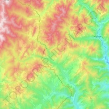
Name: Starchiojd topographic map, elevation, terrain.
Location: Starchiojd, Prahova, Roemenië (45.28409 26.07695 45.48551 26.23367)
Average elevation: 762 m
Minimum elevation: 313 m
Maximum elevation: 1,470 m