
Hillsboro topographic map
Interactive map
Click on the map to display elevation.
About this map
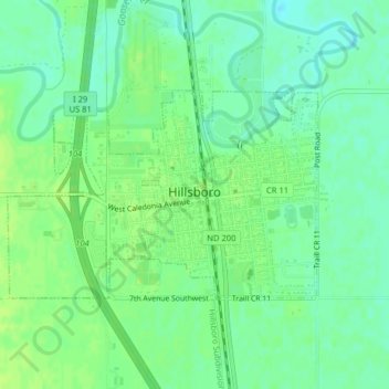
Name: Hillsboro topographic map, elevation, terrain.
Location: Hillsboro, Traill County, North Dakota, United States (47.39647 -97.08123 47.41088 -97.04936)
Average elevation: 276 m
Minimum elevation: 269 m
Maximum elevation: 281 m
Other topographic maps
Click on a map to view its topography, its elevation and its terrain.
Portland
United States > North Dakota > Traill County
Portland, Traill County, North Dakota, 58274, United States
Average elevation: 300 m
Hatton
United States > North Dakota > Traill County
Hatton, Traill County, North Dakota, United States
Average elevation: 329 m
Mayville
United States > North Dakota > Traill County
Mayville, Traill County, North Dakota, 58257, United States
Average elevation: 296 m