
Yakutat topographic map
Interactive map
Click on the map to display elevation.
About this map
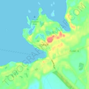
Name: Yakutat topographic map, elevation, terrain.
Location: Yakutat, Alaska, États-Unis d'Amérique (59.53200 -139.75257 59.57200 -139.71257)
Average elevation: 14 m
Minimum elevation: -8 m
Maximum elevation: 56 m
Other topographic maps
Click on a map to view its topography, its elevation and its terrain.
Yakutat
États-Unis d'Amérique > Alaska > Yakutat
Yakutat, Alaska, États-Unis d'Amérique
Average elevation: 33 m