Geolocate

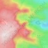
Nave topographic map

Click on the map to display elevation.

About this map

Name: Nave topographic map, elevation, terrain.

Location: Nave, Sabugal, Guarda, Portugal (40.36529 -7.00044 40.43113 -6.92016)

Average elevation: 813 m

Minimum elevation: 708 m

Maximum elevation: 890 m

Other topographic maps

Click on a map to view its topography, its elevation and its terrain.
Serra da Estrela

Portugal > Guarda > Seia

Average elevation: 1,825 m

Castelo Mendo

Portugal > Guarda > Almeida

Average elevation: 722 m

Monteperobolso

Portugal > Guarda > Almeida

Average elevation: 776 m

Aldeia da Serra

Portugal > Guarda > Celorico da Beira

Average elevation: 575 m

Linhares

Portugal > Guarda > Celorico da Beira

Average elevation: 798 m

Cabeças

Portugal > Guarda > Guarda

Average elevation: 833 m

Senhora do Desterro

Portugal > Guarda > Seia

Average elevation: 830 m

São Clemente

Portugal > Guarda > Trancoso

Average elevation: 594 m
A-dos-Ferreiros

Portugal > Guarda > Trancoso > Cótimos

Average elevation: 570 m

Aldeia da Serra

Portugal > Guarda > Celorico da Beira

Average elevation: 575 m

Cântaro Magro

Portugal > Guarda > Manteigas

Average elevation: 1,725 m

Paranhos da Beira

Portugal > Guarda > Seia

Average elevation: 379 m

Castelo Melhor

Portugal > Guarda > Vila Nova de Foz Côa

Average elevation: 391 m

Gear up for your next adventure:

🧴Tick Removal Tools - Small, essential health tool for UK woodland and moorland
🌦️Portable Weather Meters - Handheld tools for monitoring weather conditions
🥾Walking Shoes - Lightweight walking shoes for countryside and coastal paths
🔋Solar Power Banks - Keep your GPS and phone charged during multi-day expeditions
🧭Professional Hiking Compasses - High-precision liquid-filled compasses for map reading and orientation

As an Amazon Associate, this site earns from qualifying purchases at no extra cost to you.