
Lede topographic map
Interactive map
Click on the map to display elevation.
About this map
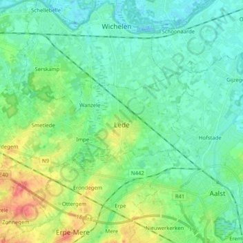
Name: Lede topographic map, elevation, terrain.
Location: Lede, Aalst, Flandre orientale, Flandre, 9340, Belgique (50.94755 3.86754 50.98717 4.02404)
Average elevation: 17 m
Minimum elevation: -2 m
Maximum elevation: 64 m
Other topographic maps
Click on a map to view its topography, its elevation and its terrain.
Alost
Belgique > Flandre orientale > Aalst
Alost, Aalst, Flandre orientale, Flandre, Belgique
Average elevation: 20 m
Ninove
Belgique > Flandre orientale > Aalst
Ninove, Aalst, Flandre orientale, Belgique
Average elevation: 36 m