Geolocate

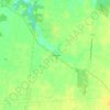
Sardinia topographic map

Click on the map to display elevation.

About this map

Name: Sardinia topographic map, elevation, terrain.

Location: Sardinia, Washington Township, Brown County, Ohio, United States (38.99361 -83.82078 39.02028 -83.77934)

Average elevation: 291 m

Minimum elevation: 277 m

Maximum elevation: 303 m

Other topographic maps

Click on a map to view its topography, its elevation and its terrain.

Feesburg

United States > Ohio > Brown County

Average elevation: 280 m

Chasetown

United States > Ohio > Brown County

Average elevation: 288 m

Yankeetown

United States > Ohio > Brown County

Average elevation: 284 m

Gear up for your next adventure:

🖼️Topographic Map Art - Decorative 3D-effect posters of famous UK peaks and regions
🛌Sleeping Bags - Warm and packable sleeping bags for outdoor nights
🥤Collapsible Water Bottles - Save space in your rucksack as you consume your water
🩹Hiking First Aid Kits - Compact medical kits tailored for trail injuries and emergencies
🧥Waterproof Hiking Jackets - Rain protection for walking in all weather conditions

As an Amazon Associate, this site earns from qualifying purchases at no extra cost to you.