
Monte Serra topographic map
Interactive map
Click on the map to display elevation.
About this map
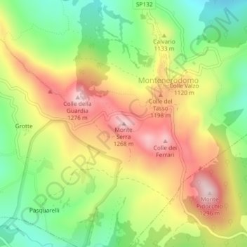
Name: Monte Serra topographic map, elevation, terrain.
Location: Monte Serra, Montenerodomo, Chieti, Abruzzo, 66019, Italia (41.97081 14.24617 41.97091 14.24627)
Average elevation: 1,091 m
Minimum elevation: 933 m
Maximum elevation: 1,264 m